Légende
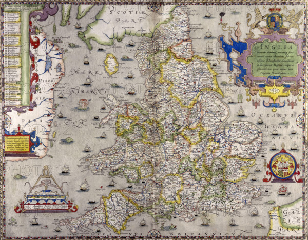
A map of England and Wales, 1583. The various main cities and towns have been numbered and listed on the left. The eastern coastline of Ireland (Hiberniæ), and the main towns along it have been highlighted. In the bottom right corner is part of the French coast. The surrounding waters are filled with boats of all sizes, sea monsters, fish, and even a mermaid with Neptune (to the left of Holyhead).
Date
1583
Crédit
Photo12/Heritage Images/Heritage Art
Notre référence
HRM25A15_332
Model release
NA
Property release
NA
Licence
Droits gérés
Format disponible
51,1Mo (4,2Mo) / 40,5cm x 31,6cm / 4783 x 3731 (300dpi)